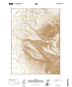
2020 Map of Chignik C-3 SW
USGS Topo · Published 2020About this map
The Alaska Peninsula serves as the backdrop for this topographic study, where the landscape is defined by its dramatic relief and water drainage systems. Significant water bodies such as Crater Cr and Charles Cr carve through the terrain, illustrating the hydrological patterns of this remote coastal region. To the southeast, Ash Cr further defines the watershed. The map provides a detailed view of the township and range divisions, specifically within t41s r62w, t41s r61w, t42s r62w, and t42s r61w, which organize this largely undeveloped territory. The contour density reveals steep elevations typical of the peninsula's geography, offering a precise look at the landforms as they existed in the early twenty-first century.
Find a feature on this map
8 named features on this map. Tap any name to fly to it.
Don’t see what you’re looking for? This feature index may not catch every label — zoom into the map to look around manually.
Map Details
Editions of this 2020 Chignik C-3 SW Map
This is the sole edition of this map. No revisions or reprints were ever made.
Other maps of this area

1963 · Chignik C-3
USGS Topo · 1:63,360

1963 · Chignik C-4
USGS Topo · 1:63,360

1963 · Chignik B-4
USGS Topo · 1:63,360

1963 · Chignik B-3
USGS Topo · 1:63,360

1963 · Chignik
USGS Topo · 1:250,000
2020 · Chignik C-4 SE
USGS Topo · 1:25,000
2020 · Chignik B-3 NW
USGS Topo · 1:25,000
2020 · Chignik C-3 NW
USGS Topo · 1:25,000
2020 · Chignik B-4 NE
USGS Topo · 1:25,000
2020 · Chignik B-3 NE
USGS Topo · 1:25,000