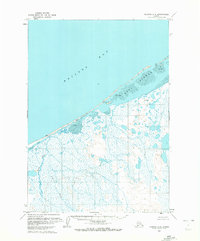
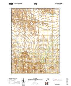
1963 Map of Chignik C-5
USGS Topo · Published 1972About this map
Bristol Bay defines the northwestern reaches of this 1963 coastal survey, where a string of barrier formations known as the Seal Islands protects a complex network of lagoons and marshes. The small settlement of Ilnik is situated where the Ilnik Lake and the Ilnik River meet the coast, illustrating the vital connection between freshwater drainage and the sea in this part of the Alaska Peninsula. Extensive Tidal Flats dominate the shoreline, particularly around the Seal Islands, indicating a landscape shaped by extreme tidal shifts. Moving inland, the map records the meandering path of Fog Creek through a marshy plain dotted with small ponds and markers such as Snipe and Chief. The inclusion of an isolated Cabin along the coast reflects the sparse but essential human presence in a region driven by seasonal fishing and subsistence.
Find a feature on this map
10 named features on this map. Tap any name to fly to it.
Don’t see what you’re looking for? This feature index may not catch every label — zoom into the map to look around manually.
Map Details
Editions of this 1963 Chignik C-5 Map
2 editions found
Other maps of this area

1963 · Chignik C-4
USGS Topo · 1:63,360

1963 · Chignik B-5
USGS Topo · 1:63,360

1963 · Chignik B-4
USGS Topo · 1:63,360

1963 · Chignik B-6
USGS Topo · 1:63,360
1963 · Chignik C-6
USGS Topo · 1:63,360
1963 · Chignik D-4
USGS Topo · 1:63,360

1963 · Chignik C-5
USGS Topo · 1:63,360

1963 · Chignik
USGS Topo · 1:250,000
2020 · Chignik C-6 SE
USGS Topo · 1:25,000
2020 · Chignik B-5 NE
USGS Topo · 1:25,000