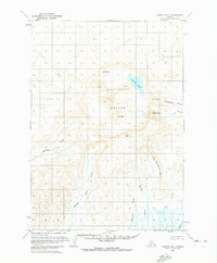
1963 Map of Chignik D-1
USGS Topo · Published 1972About this map
The Aniakchak Crater dominates this 1963 survey, revealing a landscape defined by volcanic activity in the Aleutian Range. At the heart of the caldera lies Surprise Lake, the source of the Aniakchak River, which breaches the crater wall through a narrow passage known as The Gates. Internal features like Vent Mtn and Half Cone illustrate the secondary eruptions that have shaped the crater floor, while the surrounding rim is marked by prominent high points such as Aniakchak Peak and Black Nose.
Find a feature on this map
17 named features on this map. Tap any name to fly to it.
Don’t see what you’re looking for? This feature index may not catch every label — zoom into the map to look around manually.
Map Details
Editions of this 1963 Chignik D-1 Map
2 editions found

Other maps of this area

1943 · Ugashik
USGS Topo · 1:250,000

1948 · Ugashik
USGS Topo · 1:250,000

1949 · Ugashik
USGS Topo · 1:250,000

1951 · Bristol Bay
USGS Topo · 1:250,000

1951 · Sutwik Island
USGS Topo · 1:250,000

1963 · Ugashik A-6
USGS Topo · 1:63,360

1963 · Chignik C-1
USGS Topo · 1:63,360

1963 · Bristol Bay
USGS Topo · 1:250,000
1963 · Bristol Bay A-2
USGS Topo · 1:63,360

1963 · Bristol Bay A-1
USGS Topo · 1:63,360