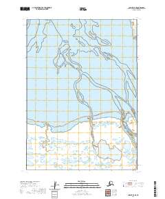
2020 Map of Chignik D-3 SE
USGS Topo · Published 2020About this map
The vast coastal lowlands and braided water channels of Alaska’s Yellow Bluff Creek dominate this landscape within the Lake and Peninsula Borough. This 2020 survey illustrates the dynamic hydrography of the region, where tidal influences and glacial runoff shape a complex network of shifting streams and wetlands. The map is defined by its Public Land Survey System grid, including townships t38s r60w, t38s r59w, and t39s r59w, which provide the essential spatial framework for land management in this remote stretch of the Alaska Peninsula. The absence of roads or permanent structures underscores the wilderness character of the terrain, making this a critical reference for understanding the natural drainage patterns and topographical layout of the Chignik area.
Find a feature on this map
7 named features on this map. Tap any name to fly to it.
Don’t see what you’re looking for? This feature index may not catch every label — zoom into the map to look around manually.
Map Details
Editions of this 2020 Chignik D-3 SE Map
This is the sole edition of this map. No revisions or reprints were ever made.
Other maps of this area

1963 · Chignik C-3
USGS Topo · 1:63,360

1963 · Chignik D-3
USGS Topo · 1:63,360

1963 · Chignik C-2
USGS Topo · 1:63,360

1963 · Chignik
USGS Topo · 1:250,000

1963 · Chignik D-2
USGS Topo · 1:63,360
2020 · Chignik D-3 SW
USGS Topo · 1:25,000
2020 · Chignik D-2 NW
USGS Topo · 1:25,000
2020 · Chignik C-3 NW
USGS Topo · 1:25,000
2020 · Chignik D-3 NW
USGS Topo · 1:25,000
2020 · Chignik D-2 SW
USGS Topo · 1:25,000