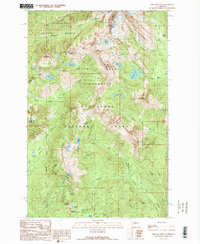
1989 Map of Chikamin Peak
USGS Topo · Published 1989About this map
Pacific Crest National Scenic Trail winds through the high-elevation boundary between Snoqualmie National Forest and Wenatchee National Forest, documenting the landscape of the Cascades as it appeared in the late 1980s. This survey focuses on the protected Alpine Lakes Wilderness, where the terrain is defined by a dense concentration of subalpine basins. These include Spectacle Lake, Rachel Lake, and the Rampart Lakes chain tucked beneath Rampart Ridge.
Find a feature on this map
64 named features on this map. Tap any name to fly to it.
Don’t see what you’re looking for? This feature index may not catch every label — zoom into the map to look around manually.
Map Details
Editions of this 1989 Chikamin Peak Map
2 editions found
Other maps of this area

1901 · Snoqualmie Pass
USGS Topo · 1:125,000

1902 · Skykomish
USGS Topo · 1:125,000

1903 · Snoqualmie
USGS Topo · 1:125,000

1905 · Skykomish
USGS Topo · 1:125,000

1957 · Wenatchee
USGS Topo · 1:250,000

1961 · Snoqualmie Pass
USGS Topo · 1:62,500

1961 · Kachess Lake
USGS Topo · 1:62,500

1965 · Mount Daniel
USGS Topo · 1:24,000
1965 · Snoqualmie Lake
USGS Topo · 1:24,000
1965 · Big Snow Mtn
USGS Topo · 1:24,000