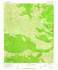
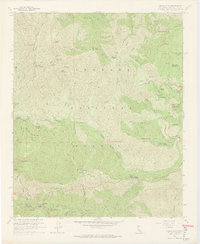
1959 Map of Chilao Flat
USGS Topo · Published 1963About this map
Monte Cristo Mine and several other prospecting sites like the Loomis Mine and Falcon Mine dot the high elevations of the Angeles National Forest in this late 1950s survey. The landscape is defined by its network of deep canyons and prominent peaks, including Granite Mtn and Strawberry Peak, where drainage systems like Big Tujunga Canyon and Arroyo Seco carve through the terrain. Human activity is centered on a series of specialized outposts and mountain retreats, such as Loomis Ranch, Colby Ranch, and the Newcomb Ranch. The presence of the Barley Flats Military Reservation and multiple forest service facilities like Chilao Station and Charlton Station indicates the area's dual role as a managed resource and a strategic overlook. Recreational use is well-established through numerous camps and picnic areas, including Camp Hi-Hill and Charlton Flats Picnic Grounds, all linked by the winding path of the Angeles Crest Highway.
Find a feature on this map
66 named features on this map. Tap any name to fly to it.
Don’t see what you’re looking for? This feature index may not catch every label — zoom into the map to look around manually.
Map Details
Editions of this 1959 Chilao Flat Map
7 editions found
Other maps of this area

1894 · Los Angeles
USGS Topo · 1:62,500

1894 · Pomona
USGS Topo · 1:62,500

1896 · Pasadena
USGS Topo · 1:62,500

1897 · Pomona
USGS Topo · 1:62,500

1898 · Pomona
USGS Topo · 1:62,500

1900 · Pasadena
USGS Topo · 1:62,500

1900 · Tujunga
USGS Topo · 1:62,500

1900 · Los Angeles
USGS Topo · 1:62,500

1901 · Southern California Sheet No. 1
USGS Topo · 1:250,000

1903 · Rock Creek
USGS Topo · 1:62,500