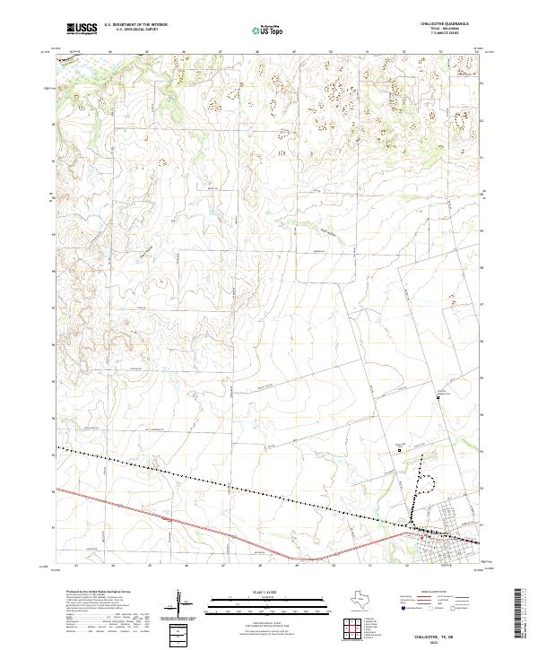
2022 Map of Chillicothe
USGS Topo · Published 2022About this map
Chillicothe serves as the primary hub in this corner of North Texas, situated at the junction of FM 91 and Us HWY 287. The town layout is defined by its proximity to agricultural corridors and the local drainage systems that feed toward the Red River, which forms the northern boundary of the sheet. The landscape is marked by several named draws and watercourses, including Wanderers Cr, Plum Hollow, and Ewell Hollow, which shape the rural road network.
Find a feature on this map
59 named features on this map. Tap any name to fly to it.
Don’t see what you’re looking for? This feature index may not catch every label — zoom into the map to look around manually.
Map Details
Editions of this 2022 Chillicothe Map
This is the sole edition of this map. No revisions or reprints were ever made.
Other maps of this area

1955 · Lawton
USGS Topo · 1:250,000

1958 · Vernon
USGS Topo · 1:62,500

1958 · Medicine Mound
USGS Topo · 1:62,500

1958 · Elmer
USGS Topo · 1:62,500

1960 · Quanah
USGS Topo · 1:62,500

1975 · Quanah NE
USGS Topo · 1:24,000

1975 · Quanah NW
USGS Topo · 1:24,000

1983 · Tolbert
USGS Topo · 1:24,000

1983 · Big Mound
USGS Topo · 1:24,000
1983 · Medicine Mound
USGS Topo · 1:24,000