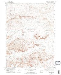
1969 Map of Chimney Butte
USGS Topo · Published 1995About this map
Industrial expansion and resource extraction define this 1969 landscape in Sublette County, where an extensive Oil Field is marked by a network of Gas Wells, Oil Wells, and numerous Drill Holes. The rugged topography is anchored by Chimney Butte, with water management appearing through the Chimney Butte Reservoir and Flat Top Reservoir to support the local operations. Transportation in this high-desert environment relies on the Calpet Road and Big Piney Calpet Road, which traverse the complex terrain of the Dry Basin. The map captures a moment of significant geological exploration, including the Chimney Butte Pit No 3 and a network of underground infrastructure indicated by a prominent Pipeline. These features reflect the mid-century energy boom that transformed this portion of the Wyoming basins.
Find a feature on this map
22 named features on this map. Tap any name to fly to it.
Don’t see what you’re looking for? This feature index may not catch every label — zoom into the map to look around manually.
Map Details
Editions of this 1969 Chimney Butte Map
2 editions found
Other maps of this area

1939 · Big Piney
USGS Topo · 1:125,000

1942 · Big Piney
USGS Topo · 1:125,000

1955 · Preston
USGS Topo · 1:250,000

1958 · Preston
USGS Topo · 1:250,000

1962 · Preston
USGS Topo · 1:250,000

1969 · Chimney Butte
USGS Topo · 1:24,000

1969 · La Barge
USGS Topo · 1:24,000
1969 · Milleson Draw
USGS Topo · 1:24,000

1969 · Cretaceous Mountain
USGS Topo · 1:24,000
1969 · The Hogsback
USGS Topo · 1:24,000