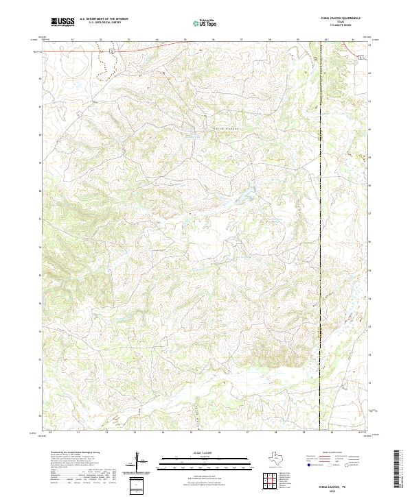
2022 Map of China Canyon
USGS Topo · Published 2022About this map
China Canyon dominates this landscape in the southern High Plains of West Texas, where the drainage systems of Salt Cr and T-Fortyone Cr carve through the caprock. This area is characterized by its complex network of seasonal water sources and ranching infrastructure, featuring essential watering points such as China Canyon Tank and T-Fortyone Tank. The map reveals the stark topography of the breaks, where named features like Spring Canyon, Water Canyon, and the appropriately named Thief Hollow indicate a terrain shaped by erosion and limited by water availability.
Find a feature on this map
14 named features on this map. Tap any name to fly to it.
Don’t see what you’re looking for? This feature index may not catch every label — zoom into the map to look around manually.
Map Details
Editions of this 2022 China Canyon Map
This is the sole edition of this map. No revisions or reprints were ever made.
Other maps of this area

1954 · Lubbock
USGS Topo · 1:250,000

1954 · Plainview
USGS Topo · 1:250,000

1958 · Plainview
USGS Topo · 1:250,000

1966 · Ballard Camp
USGS Topo · 1:24,000

1966 · Tee Pee City
USGS Topo · 1:24,000

1966 · Devils Canyon
USGS Topo · 1:24,000

1968 · Buffalo Creek
USGS Topo · 1:24,000

1968 · Russellville
USGS Topo · 1:24,000

1968 · Grow NW
USGS Topo · 1:24,000

1968 · Dumont
USGS Topo · 1:24,000