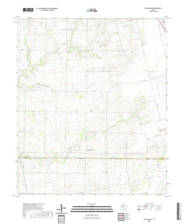
2022 Map of China Grove
USGS Topo · Published 2022About this map
China Grove sits at the heart of this landscape where the undulating plains of West Texas meet the northern reaches of the Colorado River watershed. The terrain is defined by a dense network of intermittent drainages, most notably the meandering paths of Sulphur Cr and Little Sulphur Cr. These waterways, alongside features like Wildcat Draw and Dry Run, illustrate the complex erosion patterns typical of the region's semi-arid environment. The map captures the dividing line between Scurry and Mitchell counties, showing how modern infrastructure follows these older geographic boundaries. A secondary highway system including FM 644 and E FM 1606 provides the primary framework for movement between the scattered ranching and agricultural properties that characterize this part of the state.
Find a feature on this map
40 named features on this map. Tap any name to fly to it.
Don’t see what you’re looking for? This feature index may not catch every label — zoom into the map to look around manually.
Map Details
Editions of this 2022 China Grove Map
This is the sole edition of this map. No revisions or reprints were ever made.
Other maps of this area

1950 · Cedar Bend
USGS Topo · 1:24,000

1951 · Dunn
USGS Topo · 1:24,000

1952 · Snyder
USGS Topo · 1:24,000

1952 · China Grove
USGS Topo · 1:24,000

1952 · Colorado City
USGS Topo · 1:24,000

1952 · Hermleigh
USGS Topo · 1:24,000

1954 · Big Spring
USGS Topo · 1:250,000

1958 · Big Spring
USGS Topo · 1:250,000

1969 · Inadale NW
USGS Topo · 1:24,000

1969 · Loraine
USGS Topo · 1:24,000