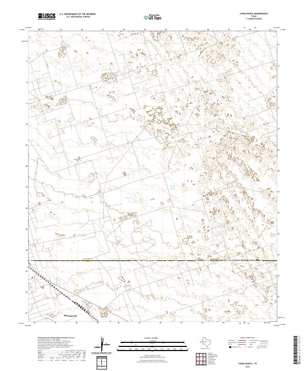
2022 Map of China Ranch
USGS Topo · Published 2022About this map
Buzzard Roost Springs provides a rare water source in this arid landscape straddling the line between Winkler Co and Ward Co. The northern portion of Monahans extends into the southwestern corner of the sheet, reflecting the slow expansion of this desert settlement into the surrounding brushland. The terrain is largely defined by the intricate network of count roads, including Co Rd 404 and Co Rd 306, which traverse the flat, semi-arid plains of the Permian Basin. This survey illustrates the modern intersection of municipal growth and the enduring isolation of the West Texas ranching country, where vital hydrological features like springs remain significant landmarks for regional navigation and history.
Find a feature on this map
5 named features on this map. Tap any name to fly to it.
Don’t see what you’re looking for? This feature index may not catch every label — zoom into the map to look around manually.
Map Details
Editions of this 2022 China Ranch Map
This is the sole edition of this map. No revisions or reprints were ever made.
Other maps of this area

1954 · Pecos
USGS Topo · 1:250,000

1957 · Pecos
USGS Topo · 1:250,000

1968 · Monahans SE
USGS Topo · 1:24,000

1968 · Cowden Place
USGS Topo · 1:24,000

1968 · China Ranch
USGS Topo · 1:24,000

1969 · Pyote NE
USGS Topo · 1:24,000

1969 · Pyote East
USGS Topo · 1:24,000

1969 · Monahans
USGS Topo · 1:24,000

1970 · Kermit
USGS Topo · 1:24,000
1971 · Amburgey Ranch
USGS Topo · 1:24,000