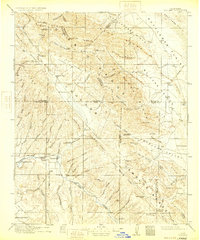
1917 Map of Cholame
USGS Topo · Published 1933About this map
Parkfield and Shandon anchor this early 20th-century landscape where the boundaries of Monterey, San Luis Obispo, Fresno, Kings, and Kern counties converge. The terrain is dominated by the parallel ridges of the Diablo Range, the Temblor Range, and the Cholame Hills, creating a complex of valleys and canyons such as Antelope Valley and the Kettleman Plain. This era was marked by diverse land use, from ranching at the Sacramento Ranch and Estrella Ranch to industrial activities represented by the Patriquin Quicksilver Mine and Kings Quicksilver Mine near Table Mountain.
Find a feature on this map
101 named features on this map. Tap any name to fly to it.
Don’t see what you’re looking for? This feature index may not catch every label — zoom into the map to look around manually.
Map Details
Editions of this 1917 Cholame Map
4 editions found
Other maps of this area

1897 · San Luis Obispo
USGS Topo · 1:62,500

1900 · San Luis
USGS Topo · 1:125,000

1912 · Coalinga
USGS Topo · 1:125,000

1912 · McKittrick
USGS Topo · 1:125,000

1914 · Lost Hills
USGS Topo · 1:125,000

1914 · Cholame
USGS Topo · 1:125,000

1915 · Priest Valley
USGS Topo · 1:125,000

1915 · Cholame
USGS Topo · 1:125,000

1917 · Cholame
USGS Topo · 1:125,000

1919 · San Miguel
USGS Topo · 1:62,500