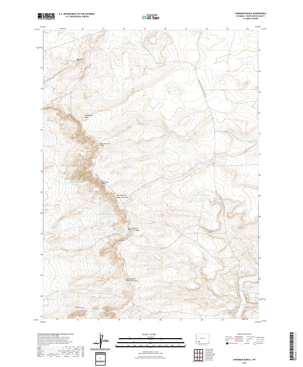
2021 Map of Chrisman Ranch
USGS Topo · Published 2021About this map
Chrisman Ranch sits along the eastern edge of this high-desert landscape in Sweetwater County, marking a site of human settlement in an area defined by complex drainage networks and arid terrain. The historical significance of the region is anchored by the Green River-South Pass Stage Rd, which traces a path through the eastern quadrants, reflecting the legacy of early western transit. The geography is characterized by the prominent Badlands Hills and a series of water management features, including Blue Rim Reservoir Number 4 and Alkali Cr Reservoir Number 2.
Find a feature on this map
24 named features on this map. Tap any name to fly to it.
Don’t see what you’re looking for? This feature index may not catch every label — zoom into the map to look around manually.
Map Details
Editions of this 2021 Chrisman Ranch Map
This is the sole edition of this map. No revisions or reprints were ever made.
Other maps of this area

1954 · Rock Springs
USGS Topo · 1:250,000

1958 · Rock Springs
USGS Topo · 1:250,000

1961 · Scott Spring
USGS Topo · 1:24,000

1961 · Austin Ranch
USGS Topo · 1:24,000

1961 · Stevens Flat
USGS Topo · 1:24,000

1962 · Rock Springs
USGS Topo · 1:250,000

1963 · Gasson Bridge
USGS Topo · 1:24,000

1963 · Pittman Well
USGS Topo · 1:24,000

1963 · Big Island Bridge
USGS Topo · 1:24,000
1963 · Chrisman Ranch
USGS Topo · 1:24,000