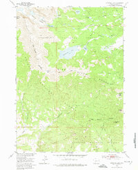
1953 Map of Christina Lake
USGS Topo · Published 1974About this map
Wind River Range high-country terrain defines this mid-century survey, centered on the high-altitude waters of Christina Lake and the rugged continental divide. The landscape is characterized by a dense network of glacial lakes and river headwaters, including Louis Lake, Atlantic Lake, and the winding Little Popo Agie River. The map captures the administrative intersection of the Shoshone National Forest and Bridger National Forest, with their shared Forest Boundary traversing the peaks.
Find a feature on this map
32 named features on this map. Tap any name to fly to it.
Don’t see what you’re looking for? This feature index may not catch every label — zoom into the map to look around manually.
Map Details
Editions of this 1953 Christina Lake Map
3 editions found
Other maps of this area

1953 · Sweetwater Gap
USGS Topo · 1:24,000

1953 · Cony Mountain
USGS Topo · 1:24,000

1953 · Fossil Hill
USGS Topo · 1:24,000

1953 · Louis Lake
USGS Topo · 1:24,000

1953 · South Pass City
USGS Topo · 1:24,000

1953 · Christina Lake
USGS Topo · 1:24,000

1955 · Lander
USGS Topo · 1:250,000

1958 · Lander
USGS Topo · 1:250,000

1958 · Parting of the Ways
USGS Topo · 1:62,500

1961 · Lander
USGS Topo · 1:250,000