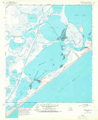
1965 Map of Christmas Point
USGS Topo · Published 1966About this map
Follets Island acts as a barrier between the Gulf of Mexico and a complex network of coastal bays and inlets in this mid-1960s survey of the Texas shoreline. The geography is defined by its shallow maritime features, including the sprawling Christmas Bay and Bastrop Bay, which are separated by the narrow peninsula of Christmas Point. This era shows the developed Intracoastal Waterway cutting a straight line through the wetlands, bypassing older natural channels like Big Slough and Bastrop Bayou. Nautical hazards and landmarks are carefully noted, including a wreck near San Luis Island and exposed masts within the bay. Significant to the local economy and navigation are features like the Landing Strip on the barrier island and the Missouri Pacific rail line at the northwestern edge, while inland basins like Cox Lake and Salt Lake fill the low-lying marshlands.
Find a feature on this map
43 named features on this map. Tap any name to fly to it.
Don’t see what you’re looking for? This feature index may not catch every label — zoom into the map to look around manually.
Map Details
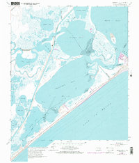
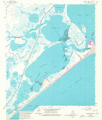
Editions of this 1965 Christmas Point Map
3 editions found
Other maps of this area

1929 · Karankawa Lake
USGS Topo · 1:24,000

1933 · Karankawa Lake
USGS Topo · 1:31,680

1933 · San Luis Pass
USGS Topo · 1:31,680

1943 · San Luis Pass
USGS Topo · 1:31,680

1943 · Oyster Creek
USGS Topo · 1:31,680

1943 · Danbury
USGS Topo · 1:31,680

1943 · Freeport
USGS Topo · 1:31,680
1943 · Carancahua Lake
USGS Topo · 1:24,000

1943 · Christmas Point
USGS Topo · 1:24,000

1943 · Chocolate Bay
USGS Topo · 1:24,000