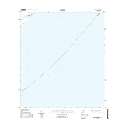
2016 Map of Christmas Point OE S
USGS Topo · Published 2016About this map
Intracoastal Waterway traffic and coastal access define this 2016 coastal segment of Brazoria Co. The map focuses heavily on the aquatic expanse of the Gulf, with the land area concentrated in the upper northwest corner. This terrestrial corner includes Drum Point and a small network of local roads that serve the shoreline community. Residents and visitors navigate via Blue Water Hwy and smaller local connectors such as Palm St and Gulf Dr. The transit pattern suggests a landscape primarily dedicated to coastal recreation and maritime industry, where Co Rd 257 and Co Rd 257b provide the essential links between the shoreline and the mainland, navigating the narrow strip of land above the waterway.
Find a feature on this map
9 named features on this map. Tap any name to fly to it.
Don’t see what you’re looking for? This feature index may not catch every label — zoom into the map to look around manually.
Map Details
Editions of this 2016 Christmas Point OE S Map
This is the sole edition of this map. No revisions or reprints were ever made.
Other maps of this area

1933 · San Luis Pass
USGS Topo · 1:31,680

1943 · San Luis Pass
USGS Topo · 1:31,680

1943 · Oyster Creek
USGS Topo · 1:31,680

1943 · Freeport
USGS Topo · 1:31,680

1943 · Christmas Point
USGS Topo · 1:24,000

1950 · Houston
USGS Topo · 1:250,000

1951 · Bay City
USGS Topo · 1:250,000

1956 · Houston
USGS Topo · 1:250,000

1956 · Bay City
USGS Topo · 1:250,000

1958 · Bay City
USGS Topo · 1:250,000