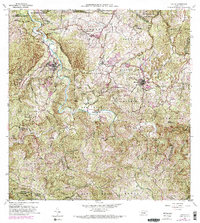
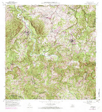
1957 Map of Ciales
USGS Topo · Published 1982About this map
Ciales and Morovis serve as the primary hubs in this mid-century portrait of interior Puerto Rico, where the winding Rio Grande de Manati carves deep valleys through the limestone karst and cordillera. The landscape is defined by the transition from agriculture to community centers, evidenced by the numerous specialized educational sites like Escuela Dr Liborio Cordova and Escuela Segunda Unidad de Pozas. Smaller rural settlements and family estates such as Hacienda Maria are connected by a developing network of island routes, including Highway 149.
Find a feature on this map
76 named features on this map. Tap any name to fly to it.
Don’t see what you’re looking for? This feature index may not catch every label — zoom into the map to look around manually.
Map Details
Editions of this 1957 Ciales Map
5 editions found
Other maps of this area

1940 · Vega Alta
USGS Topo · 1:30,000

1942 · Manati
USGS Topo · 1:30,000

1942 · Barceloneta
USGS Topo · 1:30,000

1946 · Corozal
USGS Topo · 1:30,000

1946 · Barranquitas
USGS Topo · 1:30,000

1946 · Barceloneta
USGS Topo · 1:30,000

1946 · Ciales
USGS Topo · 1:30,000

1946 · Jayuya
USGS Topo · 1:30,000

1946 · Florida
USGS Topo · 1:30,000

1946 · Vega Alta
USGS Topo · 1:30,000
Featured Places
- Ciales
- Morovis
- Sector La Loma de los Castro, Vega Baja
- Sector La Alianza, Morovis
- Sector Vereda, Morovis