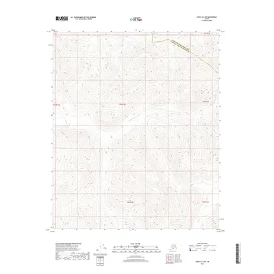
2018 Map of Circle A-2 SW
USGS Topo · Published 2018About this map
The Middle Fork Chena River meanders across this interior landscape, marking a vital watercourse in the Tanana Valley watershed. The river's path defines the central topography of this region, which is bifurcated by the administrative boundary between the Yukon-Koyukuk Census Area and the Fairbanks North Star Borough. This 2018 survey reveals a territory primarily defined by its hydrology and high-altitude contours, where natural drainage patterns dictate the character of the land. The absence of established roads or buildings emphasizes the wilderness nature of the area, making the water systems and borough lines the primary markers for navigation and land management. Researchers can trace the precise intersection of these regional boundaries as they relate to the surrounding ridges and the river's upper reaches.
Find a feature on this map
8 named features on this map. Tap any name to fly to it.
Don’t see what you’re looking for? This feature index may not catch every label — zoom into the map to look around manually.
Map Details
Editions of this 2018 Circle A-2 SW Map
This is the sole edition of this map. No revisions or reprints were ever made.
Other maps of this area

1950 · Big Delta
USGS Topo · 1:250,000

1951 · Big Delta
USGS Topo · 1:250,000

1951 · Circle
USGS Topo · 1:250,000

1955 · Circle A-2
USGS Topo · 1:63,360

1955 · Circle A-3
USGS Topo · 1:63,360

1955 · Circle
USGS Topo · 1:250,000

1958 · Big Delta D-3
USGS Topo · 1:63,360

1958 · Big Delta D-2
USGS Topo · 1:63,360

1958 · Big Delta
USGS Topo · 1:250,000

1964 · Circle
USGS Topo · 1:250,000