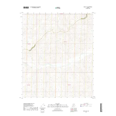
2018 Map of Circle A-3 SE
USGS Topo · Published 2018About this map
The Middle Fork Chena River flows through this interior Alaskan wilderness, carving a wide valley between the high ridges of the Yukon-Tanana Upland. This 2018 survey documents the intricate drainage network of the region, where numerous named tributaries such as Caribou Cr, Mascot Cr, and Salmonfoot Cr descend from the upland divides to feed the main river fork. The terrain is marked by the administrative boundary between the Yukon-Koyukuk Census Area and Fairbanks North Star Borough, a line that cuts across the high country north of the river. Small, steep-walled drainages like Cash Cr, Anvil Cr, and Dexter Cr define the northern portion of the quadrangle, illustrating the complex topography of this roadless area.
Find a feature on this map
13 named features on this map. Tap any name to fly to it.
Don’t see what you’re looking for? This feature index may not catch every label — zoom into the map to look around manually.
Map Details
Editions of this 2018 Circle A-3 SE Map
This is the sole edition of this map. No revisions or reprints were ever made.
Other maps of this area

1950 · Big Delta
USGS Topo · 1:250,000

1951 · Big Delta
USGS Topo · 1:250,000

1951 · Circle
USGS Topo · 1:250,000

1955 · Circle A-2
USGS Topo · 1:63,360

1955 · Circle A-3
USGS Topo · 1:63,360

1955 · Circle
USGS Topo · 1:250,000

1958 · Big Delta D-3
USGS Topo · 1:63,360

1958 · Big Delta D-2
USGS Topo · 1:63,360

1958 · Big Delta
USGS Topo · 1:250,000

1964 · Circle
USGS Topo · 1:250,000