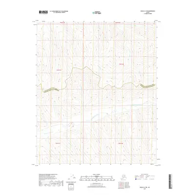
2018 Map of Circle A-3 SW
USGS Topo · Published 2018About this map
The Middle Fork Chena River meanders across the southern half of this landscape, marking a significant hydrologic artery in the interior of Alaska. This 2018 survey captures a remote wilderness area where the Yukon-Koyukuk Census Area Fairbanks North Star Borough boundary cuts an east-west line across the high ground. The terrain is defined by a dense network of drainages feeding into the river system, including Montana Cr, California Cr, and Cash Cr flowing from the north, and Shamrock Cr and Ohio Cr from the south. The absence of roads or structures highlights the pristine nature of this subarctic environment, dominated by topographic contours and the natural flow of these many named creeks. These water bodies serve as the primary landmarks for navigating the high ridges and deep valleys of the Chena River's middle fork watershed.
Find a feature on this map
17 named features on this map. Tap any name to fly to it.
Don’t see what you’re looking for? This feature index may not catch every label — zoom into the map to look around manually.
Map Details
Editions of this 2018 Circle A-3 SW Map
This is the sole edition of this map. No revisions or reprints were ever made.
Other maps of this area

1950 · Big Delta
USGS Topo · 1:250,000

1951 · Big Delta
USGS Topo · 1:250,000

1951 · Circle
USGS Topo · 1:250,000

1952 · Circle A-4
USGS Topo · 1:63,360

1955 · Circle A-3
USGS Topo · 1:63,360

1955 · Circle
USGS Topo · 1:250,000

1958 · Big Delta D-4
USGS Topo · 1:63,360

1958 · Big Delta D-3
USGS Topo · 1:63,360

1958 · Big Delta
USGS Topo · 1:250,000

1964 · Circle
USGS Topo · 1:250,000