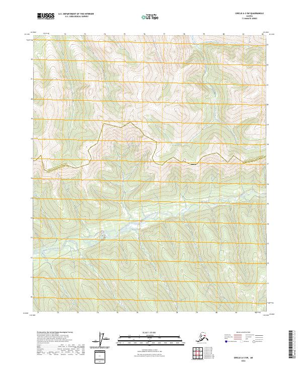
2024 Map of Circle A-3 SW
USGS Topo · Published 2024About this map
Middle Fork Chena River winds across the lower half of this landscape, serving as the primary drainage for numerous tributaries flowing down from the high ridges of the Steese National Conservation Area. The northern terrain is defined by steep elevation changes and the headwaters of Volcano Creek, Bear Creek, and Cash Creek, which feed into larger systems outside the immediate quadrangle. The map captures the administrative boundary where the Yukon-Koyukuk Census Area meets the Fairbanks North Star Borough. Significant lateral drainages such as Montana Creek and California Creek illustrate the watershed patterns of the interior Alaskan wilderness. Smaller named features like Shamrock Creek and Palmer Creek provide specific points of reference for those navigating or studying the hydrologic network of this protected region.
Find a feature on this map
17 named features on this map. Tap any name to fly to it.
Don’t see what you’re looking for? This feature index may not catch every label — zoom into the map to look around manually.
Map Details
Editions of this 2024 Circle A-3 SW Map
This is the sole edition of this map. No revisions or reprints were ever made.
Other maps of this area

1950 · Big Delta
USGS Topo · 1:250,000

1951 · Big Delta
USGS Topo · 1:250,000

1951 · Circle
USGS Topo · 1:250,000

1952 · Circle A-4
USGS Topo · 1:63,360

1955 · Circle A-3
USGS Topo · 1:63,360

1955 · Circle
USGS Topo · 1:250,000

1958 · Big Delta D-4
USGS Topo · 1:63,360

1958 · Big Delta D-3
USGS Topo · 1:63,360

1958 · Big Delta
USGS Topo · 1:250,000

1964 · Circle
USGS Topo · 1:250,000