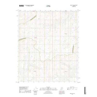
2018 Map of Circle A-4 SE
USGS Topo · Published 2018About this map
Jones Pass serves as a prominent high point in this subarctic landscape, where the administrative boundaries of the Fairbanks North Star Borough and Yukon-Koyukuk Census Area meet. The terrain is defined by a dense network of drainage systems, including the N Fork Chena River in the northwest and the Middle Fork Chena River in the southeast. Numerous named tributaries such as Munson Cr, Ottertail Cr, and Sullivan Cr carve through the topography, illustrating the complex watershed that feeds the larger Chena River system. This 2018 survey detail provides a clear view of the wilderness area before these forks converge downstream, showing a landscape primarily shaped by its waterways and high ridges rather than human infrastructure.
Find a feature on this map
15 named features on this map. Tap any name to fly to it.
Don’t see what you’re looking for? This feature index may not catch every label — zoom into the map to look around manually.
Map Details
Editions of this 2018 Circle A-4 SE Map
This is the sole edition of this map. No revisions or reprints were ever made.
Other maps of this area

1950 · Big Delta
USGS Topo · 1:250,000

1951 · Big Delta
USGS Topo · 1:250,000

1951 · Circle
USGS Topo · 1:250,000

1952 · Circle A-4
USGS Topo · 1:63,360

1955 · Circle A-3
USGS Topo · 1:63,360

1955 · Circle
USGS Topo · 1:250,000

1958 · Big Delta D-4
USGS Topo · 1:63,360

1958 · Big Delta D-3
USGS Topo · 1:63,360

1958 · Big Delta
USGS Topo · 1:250,000

1964 · Circle
USGS Topo · 1:250,000