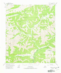
1952 Map of Circle A-5
USGS Topo · Published 1982About this map
Chena Hot Springs serves as the focal point of this interior Alaskan landscape, marking a site of geothermal activity and early 1950s development. The Chena Hot Springs Road provides the primary artery into the territory, terminating near a Landing Strip and a Gaging Sta along the upper reaches of the Chena River. The topography is defined by significant elevations such as Mt Ryan in the north and the prominent Chena Dome to the southwest. Much of the southern portion of the quadrangle is dedicated to the Chena River Recreation Area, reflecting the transition of the wilderness into a managed landscape for public use. Numerous waterways, including Frozenfoot Creek, Angel Creek, and Monument Creek, create a complex drainage system through the high country of the Fairbanks North Star Borough.
Find a feature on this map
19 named features on this map. Tap any name to fly to it.
Don’t see what you’re looking for? This feature index may not catch every label — zoom into the map to look around manually.
Map Details
Editions of this 1952 Circle A-5 Map
2 editions found
Other maps of this area

1950 · Big Delta
USGS Topo · 1:250,000

1950 · Big Delta D-6
USGS Topo · 1:63,360

1951 · Big Delta
USGS Topo · 1:250,000

1951 · Circle
USGS Topo · 1:250,000

1951 · Circle A-5
USGS Topo · 1:63,360

1952 · Big Delta D-6
USGS Topo · 1:63,360

1952 · Circle A-4
USGS Topo · 1:63,360

1952 · Circle B-4
USGS Topo · 1:63,360

1952 · Circle A-5
USGS Topo · 1:63,360

1954 · Circle A-6
USGS Topo · 1:63,360