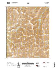
2018 Map of Circle B-3 NW
USGS Topo · Published 2018About this map
Eagle Summit stands as a prominent high point in this high-altitude landscape of the Yukon-Koyukuk region, anchoring a complex drainage system where the headwaters of numerous creeks diverge. The map reveals a distinctive radiating pattern of watercourses, including the Mastodon Fork and Miller Fork, which carve deep valleys through the upland terrain. This area is defined by its mining-era nomenclature, with names like Caribou Gulch, Bonanza Cr, and Gold Dust Cr suggesting the historical search for minerals in these remote Alaskan reaches. Mastodon Dome provides another significant landmark, overlooking the steep descents into Forty-two Gulch and the surrounding tributaries. The terrain's character is shaped by these sharp elevations and the precise network of creeks that define the landscape's structure.
Find a feature on this map
24 named features on this map. Tap any name to fly to it.
Don’t see what you’re looking for? This feature index may not catch every label — zoom into the map to look around manually.
Map Details
Editions of this 2018 Circle B-3 NW Map
This is the sole edition of this map. No revisions or reprints were ever made.
Other maps of this area

1951 · Circle
USGS Topo · 1:250,000

1952 · Circle B-4
USGS Topo · 1:63,360

1952 · Circle C-4
USGS Topo · 1:63,360

1955 · Circle B-3
USGS Topo · 1:63,360

1955 · Circle C-3
USGS Topo · 1:63,360

1955 · Circle
USGS Topo · 1:250,000

1964 · Circle
USGS Topo · 1:250,000
2018 · Circle C-4 SE
USGS Topo · 1:25,000
2018 · Circle B-3 SW
USGS Topo · 1:25,000
2018 · Circle B-4 NE
USGS Topo · 1:25,000