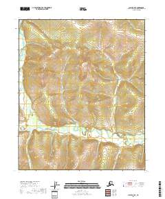
2018 Map of Circle B-4 SE
USGS Topo · Published 2018About this map
Birch Creek meanders through the heart of this Alaskan interior landscape, defining the drainage patterns of the Yukon-Koyukuk region. The area is characterized by an intricate network of tributaries, including Harrington Fork Birch Cr and Fryingpan Cr, which carve through the high-elevation terrain. This 2018 survey illustrates a remote wilderness where natural waterways remain the primary geographic anchors, devoid of modern roads or settlements. The convergence of Denver Cr and Malburn Cr in the southern reaches highlights the complex hydrology typical of this subarctic environment. The lack of man-made infrastructure suggests a landscape primarily utilized for seasonal subsistence or transit, as documented by the U.S. Geological Survey using modern elevation and hydrography datasets.
Find a feature on this map
11 named features on this map. Tap any name to fly to it.
Don’t see what you’re looking for? This feature index may not catch every label — zoom into the map to look around manually.
Map Details
Editions of this 2018 Circle B-4 SE Map
This is the sole edition of this map. No revisions or reprints were ever made.
Other maps of this area

1951 · Circle
USGS Topo · 1:250,000

1952 · Circle A-4
USGS Topo · 1:63,360

1952 · Circle B-4
USGS Topo · 1:63,360

1955 · Circle B-3
USGS Topo · 1:63,360

1955 · Circle A-3
USGS Topo · 1:63,360

1955 · Circle
USGS Topo · 1:250,000

1964 · Circle
USGS Topo · 1:250,000
2018 · Circle A-4 NE
USGS Topo · 1:25,000
2018 · Circle B-3 SW
USGS Topo · 1:25,000
2018 · Circle B-4 NE
USGS Topo · 1:25,000