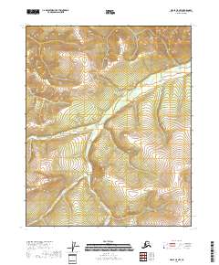
2018 Map of Circle C-5 NW
USGS Topo · Published 2018About this map
N Fork Preacher Cr snakes through this high-elevation landscape in the Yukon-Koyukuk region, defining the drainage patterns of the northern interior. This 2018 survey reveals a terrain dominated by significant relief, where the north fork of the creek and its many unnamed tributaries have carved deep valleys into the surrounding uplands. To the west, Moose Cr cuts across the township lines of T11N R6E and T10N R6E. The map detail is focused on these headwater systems, illustrating the remote and untouched character of this section of the Alaskan wilderness. Without roads or permanent settlements, the topography itself is the primary record, showing the natural transition of the watershed before these waters flow toward more traveled regions.
Find a feature on this map
8 named features on this map. Tap any name to fly to it.
Don’t see what you’re looking for? This feature index may not catch every label — zoom into the map to look around manually.
Map Details
Editions of this 2018 Circle C-5 NW Map
This is the sole edition of this map. No revisions or reprints were ever made.
Other maps of this area

1951 · Circle
USGS Topo · 1:250,000

1951 · Circle D-6
USGS Topo · 1:63,360

1951 · Circle C-6
USGS Topo · 1:63,360

1952 · Circle D-5
USGS Topo · 1:63,360

1952 · Circle C-5
USGS Topo · 1:63,360

1954 · Circle C-5
USGS Topo · 1:63,360

1954 · Circle D-5
USGS Topo · 1:63,360

1954 · Circle D-6
USGS Topo · 1:63,360
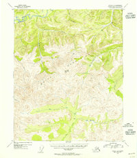
1954 · Circle C-6
USGS Topo · 1:63,360

1955 · Circle
USGS Topo · 1:250,000