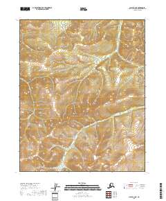
2018 Map of Circle C-6 NE
USGS Topo · Published 2018About this map
High-elevation drainages define this interior Alaskan landscape within the Yukon-Koyukuk region, where the terrain is dominated by the steep divides between the Yellow Cr and Moose Cr basins. The map illustrates a wilderness largely untouched by development, focused on the natural hydrography and elevation contours that dictate the movement of water across the North Slope of the mountains. To the southwest, Warren Cr carves through the land, indicating the complex drainage patterns characteristic of this subarctic environment. The presence of these specific named creeks provides critical geographic markers for explorers or mineral prospectors navigating the remote township sections of T10N R5E and T11N R6E.
Find a feature on this map
9 named features on this map. Tap any name to fly to it.
Don’t see what you’re looking for? This feature index may not catch every label — zoom into the map to look around manually.
Map Details
Editions of this 2018 Circle C-6 NE Map
This is the sole edition of this map. No revisions or reprints were ever made.
Other maps of this area

1951 · Circle
USGS Topo · 1:250,000

1951 · Circle D-6
USGS Topo · 1:63,360

1951 · Circle C-6
USGS Topo · 1:63,360

1952 · Circle D-5
USGS Topo · 1:63,360

1952 · Circle C-5
USGS Topo · 1:63,360

1954 · Circle C-5
USGS Topo · 1:63,360

1954 · Circle D-5
USGS Topo · 1:63,360

1954 · Circle D-6
USGS Topo · 1:63,360
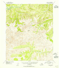
1954 · Circle C-6
USGS Topo · 1:63,360

1955 · Circle
USGS Topo · 1:250,000