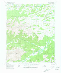
1951 Map of Circle D-6
USGS Topo · Published 1981About this map
Victoria Mountain dominates the southwestern portion of this interior Alaskan landscape, serving as a primary drainage divide for the surrounding hydrological network. Surveyed in the early 1950s, the map reveals a wilderness defined by a complex system of waterways, most notably Beaver Creek, which winds across the southeastern quadrant. The presence of a solitary Cabin near the confluence of Big Creek and East Fork in the northwest suggests the minimal human footprint of the era, likely associated with trapping or prospecting. The naming of features such as Glacier Creek, Squaw Creek, and Yellow Creek points to the early identification of prominent tributaries by explorers and land managers. The topographic data, photogrammetrically derived from 1951 aerial photography, captures the intricate drainages and unnamed ridges that characterize this portion of the Yukon-Koyukuk region before significant modern development.
Find a feature on this map
13 named features on this map. Tap any name to fly to it.
Don’t see what you’re looking for? This feature index may not catch every label — zoom into the map to look around manually.
Map Details
Editions of this 1951 Circle D-6 Map
2 editions found
Other maps of this area

1945 · Livengood
USGS Topo · 1:250,000

1951 · Fort Yukon
USGS Topo · 1:250,000

1951 · Livengood
USGS Topo · 1:250,000

1951 · Beaver
USGS Topo · 1:250,000

1951 · Circle
USGS Topo · 1:250,000

1951 · Circle D-6
USGS Topo · 1:63,360

1951 · Livengood C-1
USGS Topo · 1:63,360

1951 · Circle C-6
USGS Topo · 1:63,360

1952 · Livengood D-1
USGS Topo · 1:63,360

1952 · Circle D-5
USGS Topo · 1:63,360