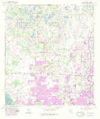
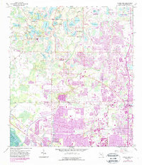
1956 Map of Citrus Park
USGS Topo · Published 1982About this map
Citrus Park and the rural fringes of Northwest Hillsborough County appear here during a transition from citrus groves and wetlands to expanding suburban centers. The landscape is defined by an intricate network of freshwater bodies, including Keystone Lake, Lake Rogers, and Lake Josephine, which historically supported the region's agricultural and homesteading activities. A notable geographic detail is the course of Brooker Creek and Rocky Creek, which drain this lake-rich terrain. Toward the southeast, the purple tint of updated surveys shows the rapid growth of the late 1970s and early 1980s encroaching on the once-remote settlements like Cosme.
Find a feature on this map
46 named features on this map. Tap any name to fly to it.
Don’t see what you’re looking for? This feature index may not catch every label — zoom into the map to look around manually.
Map Details
Editions of this 1956 Citrus Park Map
5 editions found
Other maps of this area

1921 · Tampa
USGS Topo · 1:62,500

1921 · St Petersburg
USGS Topo · 1:62,500

1943 · Gandy Bridge
USGS Topo · 1:31,680

1943 · Safety Harbor
USGS Topo · 1:31,680

1943 · Odessa
USGS Topo · 1:24,000

1943 · Elfers
USGS Topo · 1:24,000

1943 · Lutz
USGS Topo · 1:24,000

1943 · Oldsmar
USGS Topo · 1:24,000

1944 · Sulphur Springs
USGS Topo · 1:31,680

1944 · Tampa
USGS Topo · 1:31,680