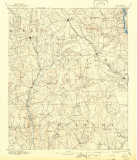
1891 Map of Clanton
USGS Topo · Published 1942About this map
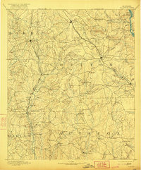
Clanton serves as the central hub of this central Alabama landscape, surveyed during the late nineteenth century as the region's transportation infrastructure was maturing. The presence of the Louisville and Nashville Railroad, Georgia and Virginia Railroad, and East Tennessee Virginia and Georgia Railroad indicates a landscape transitioning from river-dependent commerce to a rail-based economy. Despite the rise of the locomotive, the Coosa River remains a vital corridor, marked by the operations of Page's Old Ferry and Adams Ferry, and the navigation challenges posed by Butting Ram Shoals.
Find a feature on this map
82 named features on this map. Tap any name to fly to it.
Don’t see what you’re looking for? This feature index may not catch every label — zoom into the map to look around manually.
Map Details
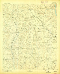
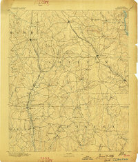
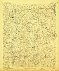
Editions of this 1891 Clanton Map
5 editions found
Historical Maps of Prattville Through Time
3 maps found

