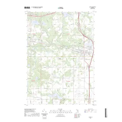
2023 Map of Clare
USGS Topo · Published 2023About this map
Clare and Farwell anchor this central Michigan landscape, where the northern forests meet the agricultural flats of the mid-state. The area is defined by a dense network of glacial water bodies, including Lake Thirteen, Otter Lake, and the complex of Five Lakes to the north. These headwaters feed into systems like the South Branch Tobacco River and the North Branch Chippewa River, which wind through a mix of residential development and open acreage.
Find a feature on this map
82 named features on this map. Tap any name to fly to it.
Don’t see what you’re looking for? This feature index may not catch every label — zoom into the map to look around manually.
Map Details
Editions of this 2023 Clare Map
This is the sole edition of this map. No revisions or reprints were ever made.
Other maps of this area

1916 · Mount Pleasant
USGS Topo · 1:62,500

1919 · Mount Pleasant
USGS Topo · 1:62,500

1930 · Shepherd
USGS Topo · 1:48,000

1936 · Shepherd
USGS Topo · 1:62,500

1943 · Mount Pleasant
USGS Topo · 1:62,500

1954 · Midland
USGS Topo · 1:250,000

1958 · Midland
USGS Topo · 1:250,000

1959 · Midland
USGS Topo · 1:250,000

1959 · Clare
USGS Topo · 1:62,500

1966 · Midland
USGS Topo · 1:250,000