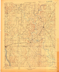
1901 Map of Claremore
USGS Topo · Published 1901About this map
The Verdigris River and Arkansas River define the landscape of this 1890s survey, conducted when the region was still divided by tribal boundaries. The junction of the Cherokee Nation, Osage Nation, and Creek Nation meets near the growing settlement of Tulsa, which is shown in its early footprint at the edge of the Indian Territory - Oklahoma line. The terrain is marked by distinctive elevations like Lipe Mound and Claremore Mound, while the river provides essential passage via the Island Ferry.
Find a feature on this map
76 named features on this map. Tap any name to fly to it.
Don’t see what you’re looking for? This feature index may not catch every label — zoom into the map to look around manually.
Map Details
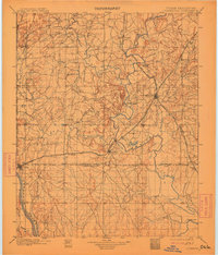
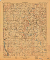
Editions of this 1901 Claremore Map
4 editions found
Other maps of this area

1896 · Okmulgee
USGS Topo · 1:125,000

1896 · Pryor
USGS Topo · 1:125,000

1900 · Okmulgee
USGS Topo · 1:125,000

1901 · Muscogee
USGS Topo · 1:125,000

1901 · Claremore
USGS Topo · 1:125,000

1901 · Nowata
USGS Topo · 1:125,000

1901 · Vinita
USGS Topo · 1:125,000

1901 · Pryor
USGS Topo · 1:125,000

1901 · Nuyaka
USGS Topo · 1:125,000

1905 · Muscogee
USGS Topo · 1:125,000