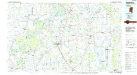
1984 Map of Clarksdale
USGS Topo · Published 1985About this map
The Mississippi River defines the western edge of this mid-1980s landscape, winding through a complex system of islands and towheads including Island No 63 and Robson Towhead. This region of the Mississippi Delta is a intricate network of drainage and transport, where the Illinois Central Gulf railroad connects agricultural hubs like Clarksdale and Tutwiler. The geography is shaped by the constant presence of water, from the expansive Moon Lake and Horseshoe Lake to the engineered Tallahatchie Floodway and the natural meanders of the Sunflower River.
Find a feature on this map
82 named features on this map. Tap any name to fly to it.
Don’t see what you’re looking for? This feature index may not catch every label — zoom into the map to look around manually.
Map Details
Editions of this 1984 Clarksdale Map
This is the sole edition of this map. No revisions or reprints were ever made.
Other maps of this area

1908 · Lula
USGS Topo · 1:24,000

1908 · Dundee
USGS Topo · 1:24,000

1908 · Coahoma
USGS Topo · 1:24,000

1908 · Moon Lake
USGS Topo · 1:24,000

1908 · Jonestown
USGS Topo · 1:24,000

1908 · Walnut Lake
USGS Topo · 1:24,000

1910 · Dundee
USGS Topo · 1:31,680

1910 · Coahoma
USGS Topo · 1:31,680

1910 · Walnut Lake
USGS Topo · 1:31,680

1910 · Jonestown
USGS Topo · 1:31,680