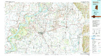
1990 Map of Clarksdale
USGS Topo · Published 1991About this map
Clarksdale serves as the focal point of this 1990 Mississippi Delta landscape, anchoring a region defined by the complex hydrology of the Mississippi River and its many tributaries. The area is characterized by an intricate network of waterways including the Sunflower River, Coldwater River, and the Hushpuckena River, alongside prominent oxbow features like Moon Lake and Desoto Lake. These water bodies and the accompanying drainage ditches reflect a landscape deeply modified for agriculture, where the alluvial soil of Coahoma County has long supported intensive farming.
Find a feature on this map
173 named features on this map. Tap any name to fly to it.
Don’t see what you’re looking for? This feature index may not catch every label — zoom into the map to look around manually.
Map Details
Editions of this 1990 Clarksdale Map
This is the sole edition of this map. No revisions or reprints were ever made.
Other maps of this area

1908 · Lula
USGS Topo · 1:24,000

1908 · Dundee
USGS Topo · 1:24,000

1908 · Coahoma
USGS Topo · 1:24,000

1908 · Moon Lake
USGS Topo · 1:24,000

1908 · Jonestown
USGS Topo · 1:24,000

1908 · Walnut Lake
USGS Topo · 1:24,000

1910 · Dundee
USGS Topo · 1:31,680

1910 · Coahoma
USGS Topo · 1:31,680

1910 · Walnut Lake
USGS Topo · 1:31,680

1910 · Jonestown
USGS Topo · 1:31,680