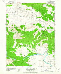
1952 Map of Clay Basin
USGS Topo · Published 1963About this map
Clay Basin Camp serves as a small pocket of human activity within a landscape dominated by the energy extraction and natural boundaries of northeastern Utah. Surveyed in the early 1950s, the map reveals a concentrated network of Gas Wells and prospects scattered across the basin floor, indicating the region's industrial focus during the post-war era. The Green River carves through the southern portion of the quadrangle, flowing through Browns Park and south of the steep elevations of Home Mountain. Significant topographic landmarks like Two Horse Butte and Goslin Mtn rise within the Ashley National Forest, while the northern border is defined by the Teepee Mountains along the Wyoming state line. This survey captures a specific moment when unimproved dirt roads were the primary corridors through the high desert terrain.
Find a feature on this map
30 named features on this map. Tap any name to fly to it.
Don’t see what you’re looking for? This feature index may not catch every label — zoom into the map to look around manually.
Map Details
Editions of this 1952 Clay Basin Map
4 editions found
Other maps of this area

1885 · Ashley
USGS Topo · 1:250,000

1952 · Warren Draw
USGS Topo · 1:24,000

1952 · Willow Creek Butte
USGS Topo · 1:24,000

1952 · Swallow Canyon
USGS Topo · 1:24,000

1952 · Clay Basin
USGS Topo · 1:24,000

1952 · Goslin Mtn
USGS Topo · 1:24,000

1954 · Vernal
USGS Topo · 1:250,000

1954 · Rock Springs
USGS Topo · 1:250,000

1957 · Currant Creek Ranch
USGS Topo · 1:62,500

1958 · Vernal
USGS Topo · 1:250,000