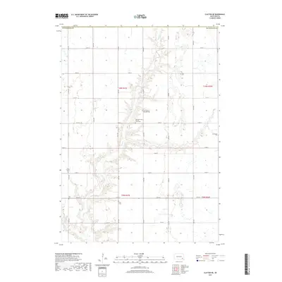
2017 Map of Clayton NE
USGS Topo · Published 2017About this map
Wolf Cr meanders through the central landscape of Pleasant Township, defining the drainage patterns of this rural Hutchinson County section. The terrain is characterized by the agricultural grid of the Public Land Survey System, which remains the primary organizing force for settlement and transportation in this 2017 study. Genealogy researchers will find significant landmarks along the local road network, most notably the Unity Lutheran Cem located in the western portion of the quadrangle. This map serves as a contemporary record of the prairie landscape, illustrating how modern land use continues to follow the section lines and riparian corridors established in the early days of South Dakota statehood.
Find a feature on this map
2 named features on this map. Tap any name to fly to it.
Don’t see what you’re looking for? This feature index may not catch every label — zoom into the map to look around manually.
Map Details
Editions of this 2017 Clayton NE Map
This is the sole edition of this map. No revisions or reprints were ever made.
Other maps of this area

1898 · Olivet
USGS Topo · 1:125,000

1898 · Parker
USGS Topo · 1:125,000

1899 · Alexandria
USGS Topo · 1:125,000

1955 · Sioux Falls
USGS Topo · 1:250,000

1957 · Tschetter Colony
USGS Topo · 1:24,000

1957 · Clayton
USGS Topo · 1:24,000

1957 · Wolf Creek
USGS Topo · 1:24,000

1958 · Sioux Falls
USGS Topo · 1:250,000

1964 · Bridgewater East
USGS Topo · 1:24,000

1970 · Clayton NE
USGS Topo · 1:24,000
Featured Places
- Pleasant Township, SD
- Taylor Township, SD
- Grandview Township, SD
- Silver Lake Township, SD
- Wolf Creek Township, SD