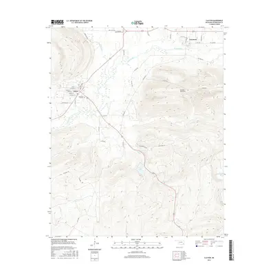
2016 Map of Clayton
USGS Topo · Published 2016About this map
Clayton and Tuskahoma anchor this study of Pushmataha County, situated at the dramatic junction of the Kiamichi River and Jackfork Creek. The landscape is dominated by the steep, rising elevations of the Kiamichi Mountains to the east, where the terrain is marked by numerous watercourses including Hurd Cr, Peal Cr, and Black Fork. The town layout of Clayton is visible in detail, showing a grid of streets such as W Choctaw St and Lawson Blvd nestled near the river's edge.
Find a feature on this map
49 named features on this map. Tap any name to fly to it.
Don’t see what you’re looking for? This feature index may not catch every label — zoom into the map to look around manually.
Map Details
Editions of this 2016 Clayton Map
This is the sole edition of this map. No revisions or reprints were ever made.
Other maps of this area

1901 · Tuskahoma
USGS Topo · 1:125,000

1901 · Alikchi
USGS Topo · 1:125,000

1908 · Tuskahoma
USGS Topo · 1:125,000

1909 · Tuskahoma
USGS Topo · 1:125,000

1950 · Mcalester
USGS Topo · 1:250,000

1962 · McAlester
USGS Topo · 1:250,000

1965 · McAlester
USGS Topo · 1:250,000

1971 · Yanush
USGS Topo · 1:24,000

1971 · Kiamichi
USGS Topo · 1:24,000
1971 · Sardis
USGS Topo · 1:24,000