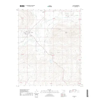
2019 Map of Clayton
USGS Topo · Published 2019About this map
Clayton serves as the focal point of this Pushmataha County landscape, situated at the base of the prominent Kiamichi Mountains. The town's grid of streets, including W Choctaw St and Cherokee St, lies just west of the Kiamichi River and Jackfork Creek confluence. Further south, the landscape is defined by the recreation and water management at Clayton Lake, which is surrounded by a dense network of forestry and access routes. The presence of the Clayton Old Town Cemetery provides a tangible link to the early residents of this river valley. The map documents a terrain transitioning from the flat river valley into the steep, rising ridges of the Kiamichi Mountains, where primitive routes like Hurd Creek Trl and Clayton Trl penetrate the higher elevations, illustrating the area's timber and recreational character.
Find a feature on this map
53 named features on this map. Tap any name to fly to it.
Don’t see what you’re looking for? This feature index may not catch every label — zoom into the map to look around manually.
Map Details
Editions of this 2019 Clayton Map
This is the sole edition of this map. No revisions or reprints were ever made.
Other maps of this area

1901 · Tuskahoma
USGS Topo · 1:125,000

1901 · Alikchi
USGS Topo · 1:125,000

1908 · Tuskahoma
USGS Topo · 1:125,000

1909 · Tuskahoma
USGS Topo · 1:125,000

1950 · Mcalester
USGS Topo · 1:250,000

1962 · McAlester
USGS Topo · 1:250,000

1965 · McAlester
USGS Topo · 1:250,000

1971 · Yanush
USGS Topo · 1:24,000

1971 · Kiamichi
USGS Topo · 1:24,000
1971 · Sardis
USGS Topo · 1:24,000