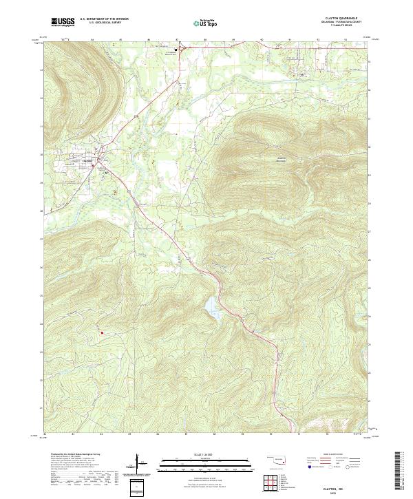
2022 Map of Clayton
USGS Topo · Published 2022About this map
Clayton serves as the focal point of this region, situated where the Kiamichi River meets the valley between towering slopes. The town's grid, including streets such as W Choctaw St and Wingler St, is hemmed in by the massive Kiamichi Mountains to the east. This landscape is defined by the complex drainage patterns of Jackfork Creek and Peal Cr, which feed into the river system. For those interested in local heritage, the Clayton Old Town Cem and A L Stephens Memorial Park provide clear markers of the community's established history.
Find a feature on this map
57 named features on this map. Tap any name to fly to it.
Don’t see what you’re looking for? This feature index may not catch every label — zoom into the map to look around manually.
Map Details
Editions of this 2022 Clayton Map
This is the sole edition of this map. No revisions or reprints were ever made.
Other maps of this area

1901 · Tuskahoma
USGS Topo · 1:125,000

1901 · Alikchi
USGS Topo · 1:125,000

1908 · Tuskahoma
USGS Topo · 1:125,000

1909 · Tuskahoma
USGS Topo · 1:125,000

1950 · Mcalester
USGS Topo · 1:250,000

1962 · McAlester
USGS Topo · 1:250,000

1965 · McAlester
USGS Topo · 1:250,000

1971 · Yanush
USGS Topo · 1:24,000

1971 · Kiamichi
USGS Topo · 1:24,000
1971 · Sardis
USGS Topo · 1:24,000