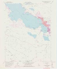
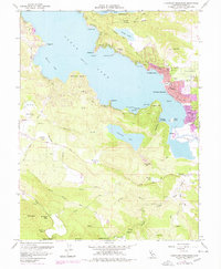
1958 Map of Clearlake Highlands
USGS Topo · Published 1978About this map
Clear Lake dominates the upper half of this topography, reflecting a mid-century period of lakeside development centered around Clearlake Highlands and Clearlake Park. The map documents a recreational and residential landscape, featuring the Burns Valley Sch and a Drive-in Theatre near the shoreline of Burns Valley. Historical activity is evident at the Sulphur Bank and nearby Borax Lake, while the southern reaches show scattered resorts and lodges like Salminas Resort and Mt Hannah Lodge tucked into the foothills of Mt Hannah. Transportation and utility infrastructure of the era is marked by the presence of Hoberg Airport and a network of secondary routes like Soda Bay Road and Lakeshore Drive that connect the various coves and landings along the waterfront.
Find a feature on this map
70 named features on this map. Tap any name to fly to it.
Don’t see what you’re looking for? This feature index may not catch every label — zoom into the map to look around manually.
Map Details
Editions of this 1958 Clearlake Highlands Map
5 editions found
Other maps of this area

1921 · Kelseyville
USGS Topo · 1:62,500

1924 · Bartlett Springs
USGS Topo · 1:62,500

1938 · Lakeport
USGS Topo · 1:62,500

1942 · Bartlett Springs
USGS Topo · 1:62,500

1943 · Kelseyville
USGS Topo · 1:62,500

1944 · Bartlett Springs
USGS Topo · 1:62,500

1945 · Lower Lake
USGS Topo · 1:62,500

1947 · Santa Rosa
USGS Topo · 1:250,000

1949 · Santa Rosa
USGS Topo · 1:250,000

1951 · Lakeport
USGS Topo · 1:62,500