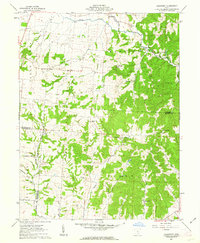
1961 Map of Clearport
USGS Topo · Published 1963About this map
Clearport and the surrounding township of Madison are situated at a complex meeting point of Pickaway, Fairfield, and Hocking Counties. This 1961 survey documents a landscape of deeply dissected valleys and high knobs, such as Emmanuel Knob, where the drainage of Clear Creek and the Middle Fork of Salt Creek have carved the terrain. The presence of several small family-named burial sites, including Shaeffer Cem, Kern Cem, and McClelland Cem, provides a detailed record for genealogists tracing local lineage in this part of Ohio.
Find a feature on this map
42 named features on this map. Tap any name to fly to it.
Don’t see what you’re looking for? This feature index may not catch every label — zoom into the map to look around manually.
Map Details
Editions of this 1961 Clearport Map
4 editions found
Other maps of this area

1906 · Chillicothe
USGS Topo · 1:62,500

1907 · Lancaster
USGS Topo · 1:62,500

1908 · Chillicothe
USGS Topo · 1:62,500

1909 · Lancaster
USGS Topo · 1:62,500

1910 · Laurelville
USGS Topo · 1:62,500

1912 · Laurelville
USGS Topo · 1:62,500

1914 · Circleville
USGS Topo · 1:62,500

1943 · Circleville
USGS Topo · 1:62,500

1944 · Laurelville
USGS Topo · 1:62,500

1947 · Columbus
USGS Topo · 1:250,000