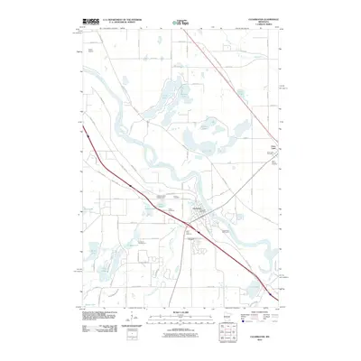
2010 Map of Clearwater
USGS Topo · Published 2010About this map
The Mississippi River and Clearwater River converge at the settlement of Clearwater, forming a prominent hydrographic hub in this 2010 study. The landscape is characterized by a high density of small lakes and wetlands, including Stickney Lake, Long Lake, and Pickerel Lake, which are interspersed with local roads like River Rd SE and County Hwy-75. On the opposite bank of the Mississippi, the settlement of Clear Lake sits near its namesake water body.
Find a feature on this map
75 named features on this map. Tap any name to fly to it.
Don’t see what you’re looking for? This feature index may not catch every label — zoom into the map to look around manually.
Map Details
Editions of this 2010 Clearwater Map
This is the sole edition of this map. No revisions or reprints were ever made.
Other maps of this area

1950 · St. Cloud
USGS Topo · 1:62,500

1951 · Annandale
USGS Topo · 1:62,500

1953 · Saint Cloud
USGS Topo · 1:250,000

1953 · Stillwater
USGS Topo · 1:250,000

1955 · Stillwater
USGS Topo · 1:250,000

1957 · Saint Cloud
USGS Topo · 1:250,000

1958 · Stillwater
USGS Topo · 1:250,000

1958 · Saint Cloud
USGS Topo · 1:250,000

1961 · Clear Lake
USGS Topo · 1:24,000

1961 · Silver Creek
USGS Topo · 1:24,000