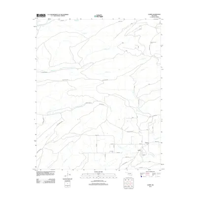
2012 Map of Clebit
USGS Topo · Published 2012About this map
The settlements of Pickens and Clebit anchor this portion of McCurtain County, Oklahoma, where a network of forest roads and timber trails crisscrosses the landscape. This region is defined by its numerous watercourses, including the Little River at the northern boundary and the meandering paths of Silver Cr, Pickens Cr, and N Watson Cr. In the southeast, the Countyline Cem serves as a vital marker for local genealogical research. Historically significant landmarks such as the Flashman Lookout Tower on the eastern edge provide a high vantage point overlooking the dense woodlands. The infrastructure is characterized by specialized routes like the Paul Stevens Trl and Silver Suck Trl, illustrating the local reliance on established trails for navigation through the timberlands.
Find a feature on this map
51 named features on this map. Tap any name to fly to it.
Don’t see what you’re looking for? This feature index may not catch every label — zoom into the map to look around manually.
Map Details
Editions of this 2012 Clebit Map
This is the sole edition of this map. No revisions or reprints were ever made.
Other maps of this area

1900 · Winding Stair
USGS Topo · 1:125,000

1901 · Tuskahoma
USGS Topo · 1:125,000

1901 · Alikchi
USGS Topo · 1:125,000

1902 · Lukfata
USGS Topo · 1:125,000

1908 · Tuskahoma
USGS Topo · 1:125,000

1909 · Tuskahoma
USGS Topo · 1:125,000

1909 · Winding Stair
USGS Topo · 1:125,000

1950 · Mcalester
USGS Topo · 1:250,000

1960 · Bethel
USGS Topo · 1:62,500

1962 · McAlester
USGS Topo · 1:250,000