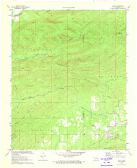
1972 Map of Clebit
USGS Topo · Published 1973About this map
The Industrial Railroad cuts through the southeastern corner of this Oklahoma landscape, terminating near the small settlement of Clebit. This 1970s survey captures a transition between the deep wooded hills of the Kiamichi and Sulphur ranges and the active industrial uses of the land. Evidence of local industry is clear in the numerous Shale Pits found near the MC Curtain Co and Pushmahata Co line, providing a glimpse into the regional extraction economy of the early 1970s.
Find a feature on this map
38 named features on this map. Tap any name to fly to it.
Don’t see what you’re looking for? This feature index may not catch every label — zoom into the map to look around manually.
Map Details
Editions of this 1972 Clebit Map
This is the sole edition of this map. No revisions or reprints were ever made.
Other maps of this area

1900 · Winding Stair
USGS Topo · 1:125,000

1901 · Tuskahoma
USGS Topo · 1:125,000

1901 · Alikchi
USGS Topo · 1:125,000

1902 · Lukfata
USGS Topo · 1:125,000

1908 · Tuskahoma
USGS Topo · 1:125,000

1909 · Tuskahoma
USGS Topo · 1:125,000

1909 · Winding Stair
USGS Topo · 1:125,000

1950 · Mcalester
USGS Topo · 1:250,000

1960 · Bethel
USGS Topo · 1:62,500

1962 · McAlester
USGS Topo · 1:250,000