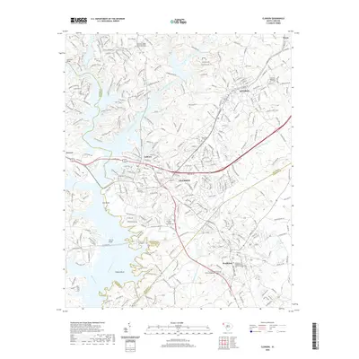
2020 Map of Clemson
USGS Topo · Published 2020About this map
Clemson and its surrounding academic and agricultural landscapes are defined by the convergence of the Seneca River, Twelvemile Creek, and Eighteenmile Creek. The area’s collegiate character is anchored by Clemson University and Southern Wesleyan University, while the neighboring town of Central and the historic village of Pendleton show a dense network of local roads and established church sites. This modern survey reflects the area's deep history through numerous historic burial grounds, including the Old Stone Church Graveyard and Lawrence Chapel United Methodist Church Graveyard. Evidence of the region’s outdoor recreation and land management is visible in the network of trails such as the Green Triangle Trail and Fant's Grove Perimeter Loop, while the Norfolk Southern railroad continues to trace the industrial corridor through the heart of the Upstate.
Find a feature on this map
63 named features on this map. Tap any name to fly to it.
Don’t see what you’re looking for? This feature index may not catch every label — zoom into the map to look around manually.
Map Details
Editions of this 2020 Clemson Map
This is the sole edition of this map. No revisions or reprints were ever made.
Other maps of this area

1888 · Pickens
USGS Topo · 1:125,000

1894 · Pickens
USGS Topo · 1:125,000

1950 · La France
USGS Topo · 1:24,000

1951 · La France
USGS Topo · 1:24,000

1951 · Clemson
USGS Topo · 1:24,000

1954 · Greenville
USGS Topo · 1:250,000

1957 · Anderson
USGS Topo · 1:62,500

1957 · Easley
USGS Topo · 1:62,500

1958 · Greenville
USGS Topo · 1:250,000

1958 · Seneca
USGS Topo · 1:24,000