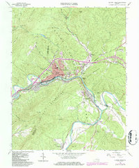
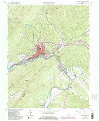
1962 Map of Clifton Forge
USGS Topo · Published 1986About this map
The Jackson River carves through the Appalachian landscape, defining the industrial and civic layout of Clifton Forge during the mid-20th century. This area, a major hub for the Chesapeake and Ohio railroad, shows a dense network of residential neighborhoods like Fairview Heights and educational centers such as Clifton Forge High School and the Dabney S Lancaster Community College. The confluence of the Jackson and Cowpasture River at the southern end of Wilson Mountain marks the headwaters of the James River, near the historic settlement of Iron Gate.
Find a feature on this map
68 named features on this map. Tap any name to fly to it.
Don’t see what you’re looking for? This feature index may not catch every label — zoom into the map to look around manually.
Map Details
Editions of this 1962 Clifton Forge Map
5 editions found
Other maps of this area

1894 · Natural Bridge
USGS Topo · 1:125,000

1894 · Natural Bridge
USGS Topo · 1:62,500

1907 · Natural Bridge Special
USGS Topo · 1:62,500

1913 · Eagle Rock
USGS Topo · 1:48,000

1915 · Eagle Rock
USGS Topo · 1:62,500

1929 · Falling Spring
USGS Topo · 1:24,000

1931 · Healing Springs
USGS Topo · 1:24,000

1932 · Falling Spring
USGS Topo · 1:31,680

1933 · Healing Springs
USGS Topo · 1:31,680

1945 · Clifton Forge
USGS Topo · 1:62,500