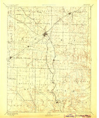
1894 Map of Clinton
USGS Topo · Published 1905About this map
Clinton serves as the central hub of this late-19th-century landscape, where a dense network of iron rails converges. The Missouri Pacific Railroad, Kansas City Clinton and Springfield Railroad, and Kansas City and Southern Railroad all intersect here, reflecting the peak of rail-driven expansion in west-central Missouri. This infrastructure supported a mosaic of small settlements and post offices like Chalk Level, Brownington, and Montrose, which were vital to the local agricultural economy before many were bypassed by modern transit corridors.
Find a feature on this map
83 named features on this map. Tap any name to fly to it.
Don’t see what you’re looking for? This feature index may not catch every label — zoom into the map to look around manually.
Map Details
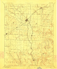
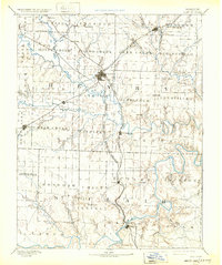
Editions of this 1894 Clinton Map
4 editions found

Other maps of this area

1884 · Bolivar
USGS Topo · 1:125,000

1885 · Warrensburg
USGS Topo · 1:125,000

1886 · Nevada
USGS Topo · 1:125,000

1886 · Stockton
USGS Topo · 1:125,000

1887 · Clinton
USGS Topo · 1:125,000

1887 · Harrisonville
USGS Topo · 1:125,000

1887 · Sedalia
USGS Topo · 1:125,000

1887 · Warsaw
USGS Topo · 1:125,000

1887 · Butler
USGS Topo · 1:125,000

1887 · Warrensburg
USGS Topo · 1:125,000