1953 Map of Cloverdale
USGS Topo · Published 1972About this map
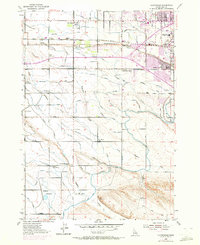
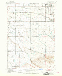
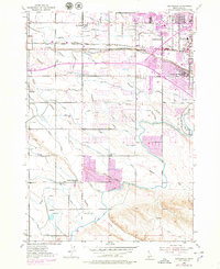
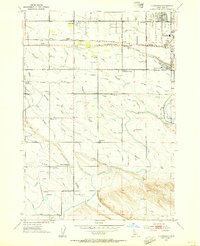
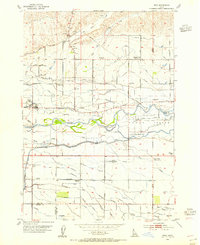
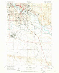
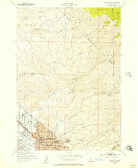
Ridenbaugh Canal and the Settlers Canal define the irrigation-heavy landscape of this region west of Boise, where the desert gives way to a network of water-delivery systems. The map illustrates the shift from rural homesteads to early suburban sprawl, with several local schools like Locust Grove Sch and Maple Grove Sch (Aban'd) serving the scattered population. Industrial and community hubs appear at Boise Junction and Perkins, while the Union Pacific rail line cuts across the northern landscape near Beatty. A distinctive rural culture is evident at the Tenmile Rodeo Grounds and the Tenmile Community Ch located along Tenmile Creek. To the south, the terrain becomes more open near the Hubbard Reservoir, where the Mason Creek Feeder and various laterals such as the Wood Lateral manage the flow of water across the Treasure Valley floor.
Find a feature on this map
53 named features on this map. Tap any name to fly to it.
Don’t see what you’re looking for? This feature index may not catch every label — zoom into the map to look around manually.
Map Details
Editions of this 1953 Cloverdale Map
4 editions found
Other maps of this area

1892 · Boise
USGS Topo · 1:125,000

1892 · Bisuka
USGS Topo · 1:125,000

1894 · Bisuka
USGS Topo · 1:125,000

1897 · Boise
USGS Topo · 1:125,000

1953 · Eagle
USGS Topo · 1:24,000
1953 · Cloverdale
USGS Topo · 1:24,000

1953 · Meridian
USGS Topo · 1:24,000
1953 · Star
USGS Topo · 1:24,000
1954 · Boise South
USGS Topo · 1:24,000
1954 · Boise North
USGS Topo · 1:24,000