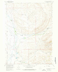
1955 Map of Coal Bank Basin
USGS Topo · Published 1976About this map
Overland Trail tracks across this high-plains landscape, marking a historical corridor of westward travel through the Coal Bank Basin. In the mid-1950s, the area was defined by a network of established cattle operations, including the Peterson Ranch and Kamp Ranch. These ranches are connected by rugged tracks and the Rattlesnake Pass Road, which cuts through the dramatic elevation of Dana Ridge.
Find a feature on this map
30 named features on this map. Tap any name to fly to it.
Don’t see what you’re looking for? This feature index may not catch every label — zoom into the map to look around manually.
Map Details
Editions of this 1955 Coal Bank Basin Map
3 editions found
Other maps of this area

1893 · Fort Steele
USGS Topo · 1:125,000

1914 · Hanna
USGS Topo · 1:62,500

1914 · Walcott
USGS Topo · 1:62,500

1954 · Rawlins
USGS Topo · 1:250,000

1955 · Overland
USGS Topo · 1:24,000

1955 · Coal Bank Basin
USGS Topo · 1:24,000

1955 · Oberg Ranch
USGS Topo · 1:24,000

1955 · Meads
USGS Topo · 1:24,000

1955 · Rattlesnake Pass
USGS Topo · 1:24,000

1955 · Coad Mountain
USGS Topo · 1:24,000