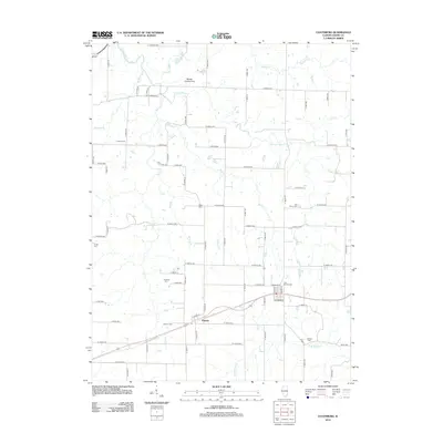
2012 Map of Coatsburg
USGS Topo · Published 2012About this map
The unincorporated settlement of Paloma serves as the primary hub in this corner of Adams County, Illinois, centered on a small cluster of streets and the local Po (Post Office). The landscape is defined by a dense network of county roads, such as N 2300th Ave and E 1700th St, that carve the prairie into precise agricultural blocks. This grid is interrupted only by the meandering paths of S Fork Bear Creek, Honey Creek, and Brushy Creek. For genealogists, the map is particularly detailed, locating several family and community burial sites including Cate Family Cemetery, Gray Mound Cemetery, and Paloma Cemetery. Further north, the private Mealiff Landing Strip and the Lubber Farm landmark highlight the region's long-standing connection to large-scale farming and rural transport infrastructure.
Find a feature on this map
74 named features on this map. Tap any name to fly to it.
Don’t see what you’re looking for? This feature index may not catch every label — zoom into the map to look around manually.
Map Details
Editions of this 2012 Coatsburg Map
This is the sole edition of this map. No revisions or reprints were ever made.
Other maps of this area

1925 · Quincy
USGS Topo · 1:62,500

1925 · Liberty
USGS Topo · 1:62,500

1927 · Liberty
USGS Topo · 1:62,500

1944 · Quincy
USGS Topo · 1:62,500

1945 · Quincy
USGS Topo · 1:62,500

1946 · Mendon
USGS Topo · 1:62,500

1948 · Quincy
USGS Topo · 1:250,000

1948 · Mendon
USGS Topo · 1:62,500

1948 · Camp Point
USGS Topo · 1:62,500

1956 · Quincy
USGS Topo · 1:250,000